
Site surveys
We are a leading CAA approved operator providing cost effective Surveying solutions to the building industry, We provide fast & accurate surveys to provide a quicker turn around of Data and thus reducing cost to our clients.
Our aircraft and camera systems provide a new dimension in the Surveying industry allowing for industry standards of accuracy to be obtained in a fraction of the time to using conventional surveying methods.
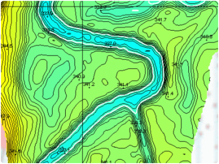
We can provide a full range of different types of survey depending on what our clients require and can provide the Data for complex drawings of Contour, Elevation & Volume surveys all at accuracy levels to meet the needs of our clients.
We can export the Data to be used Survey drawings and can be supplied in various 2D and 3D CAD formats to be used with all of the popular design software such as auto-cad,
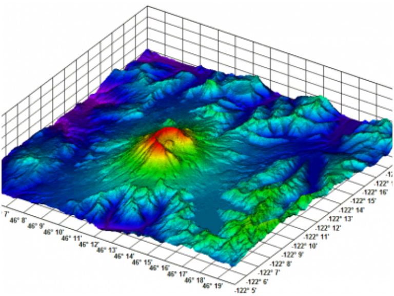
We can also provide stunning digital 3D models of the site or buildings that can show the project in connection with the surrounding land & countryside to give a clear understanding of how things will look in relation to the local area.
Contour & Elevation
Drawings
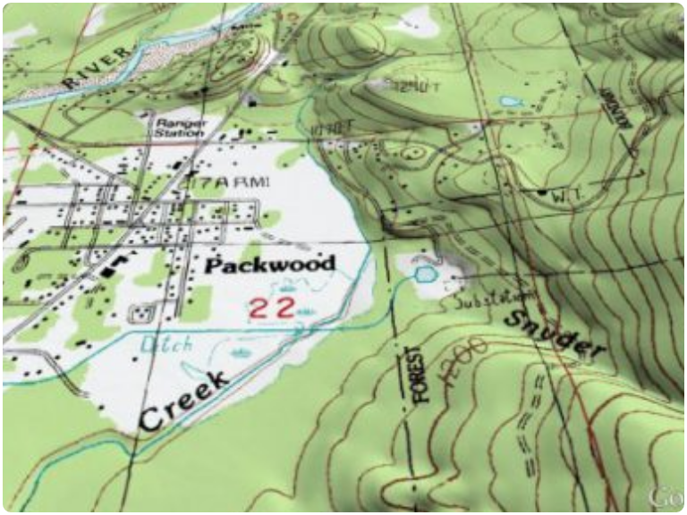
We provide accurate contour surveys for architects and planners of our clients to enable the progression of accurate drawings at the planning stage of the proposed site, this will lead to an accurate costing of the project and to help eliminate any unforeseen surprises as the project develops.
Volumetric &
Stockpile surveys
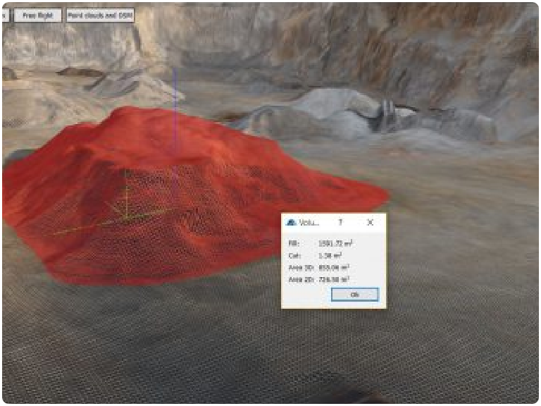
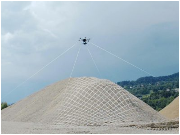
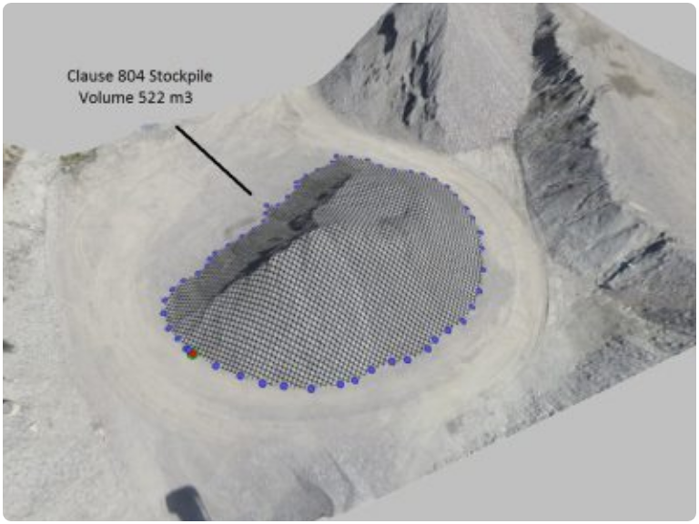
We can provide Volumetric surveys which are highly accurate to be able to ascertain the calculated stockpile volumes, this is a very useful resource when needed for example in the extraction of earth for a major development to calculate the cost of removing the soil of the earth works involved and leading to an accurate cost.
We have teamed up with a company called Pix4D who produce amazing software which enables us to use the technology and special cameras that our Drones can carry to accurately measure land or buildings which we can then transform into accurate 3D models to be used with leading design software such as Autocad.This technology can be used in a whole host of ways and is starting to transform the surveying industry, we can accurately measure distance or volume using this technology.
3D Point Cloud – Laser scanner quality 3D points from a consumer-grade camera. Clean from moving objects, with limited occlusions, and low acquisition time.
Textured Model – Full 3D triangle mesh models with photorealistic texturing, perfect for sharing and online visualization.
True Orthomosaic – High resolution aerial maps with correct perspective, putting you in control of geographic data generation.
NDVI Map – Vegetation index maps from multispectral cameras provide vital information on plants health for quick response, better yield and operational efficiency.
Property
Show property in 3D on the web, using Pix4D software to convert your drone imagery into realistic 3D mesh models.
Navigate through your model, observing property and surroundings in detail from an aerial perspective. Create customized fly-through videos to share with clients or advertise your business.
Aerial Survey
Large scale mapping and modelling has never been so accessible.
Pix4D software converts large-frame images from metric cameras and camera rigs into orthomosaics and 3D models; find a new outlook on traditional photogrammetry for surveying, city modelling, large-scale mapping, urban planning, cadaster and more.
Environmental
Capture spatially and radiometrically accurate data for environmental monitoring,
Using Pix4D’s georeferenced orthomosaics, digital elevation models, and index maps. View and monitor key resources, species, geology, habitats and more for environmental and GIS applications.
Agriculture
Capture information not visible to the naked eye, using Pix4Dmapper and a multispectral camera.
Images are converted into accurate index maps, like NDVI, and orthomosaics of your fields: giving you vital information for quick response, better yields and operational efficiency.

Weddings
Lorem ipsum dolor sit amet, consectetur adipiscing elit, sed do eiusmod tempor incididunt ut labore et dolore magna aliqua.

Aerial Photography
We are a team of CAA approved Pilots and Camera operators who are passionate about the images that we capture for our clients...
Aerial Survey
We are a leading CAA approved operator providing cost effective Surveying solutions to the building industry, we provide...
Aerial Filming
We provide ultra-smooth high definition footage obtained through using the latest 3 axis gimbals mounted onto our fleet of drones...
Aerial 360 VR
Lorem ipsum dolor sit amet, consectetur adipiscing elit, sed do eiusmod tempor incididunt ut labore et dolore magna aliqua.
Qualified
We advise on the best Practice of UAV equipment to organisations within the UK, all of our pilots are members of ARPAS which is the Governing body of the Drone Industry and of course CAA approved.
Creative
We approach each shoot from a creative point of view. we have worked hard and built up a wealth of experience and know how to get the best out of a shoot and location.
Passionate
We are passionate about creativity in all its forms which compels us to create the best possible quality. Using aerial cameras takes it to a whole new level!
Clear
We are transparent in everything we do, what you see is what you get, no hidden charges or surprises.